
Walk a Miramar Street Address
A Miramar street directory can identify the legal owner, recorded transfers, a registered voter, permit applicants, and names printed in historical address sections. Those are separate facts. The current owner may live elsewhere, while an occupant may never appear on the property roll. Start with the address because it resolves a parcel and legal description, then carry those exact facts into records indexed by name.
Keep a simple search log with the exact input, portal, result date, and source claim. If one street number fails, test the directional prefix, unit format, and legal description instead of dropping part of the address at random.
- Enter the full street address in the Broward County Property Appraiser search. Save the folio, owner, situs, mailing address, legal description, and deed reference.
- Open the parcel map and click the parcels on either side. Compare lot lines, subdivision, city boundary, and historic parcel clues.
- Search the named owner in Broward Official Records. Narrow to deeds, dates, and the legal description instead of accepting every namesake.
- Request Miramar permit or lien records for the address, noting the applicant, contractor, work, and date.
- Use a voter-file request or a library criss-cross directory only for the narrower resident question each can answer.
Resolve Miramar Parcels by Address
The BCPA Property Search turns a street address into a folio and parcel card. “Situs” means the physical property address. The mailing address is where the tax notice goes, which may belong to a trustee, company, seasonal owner, or management office. Homestead can support an owner's claim of permanent residence, but it does not enumerate the household.
| BCPA field | Use in a street search |
|---|---|
| Owner name | Move from parcel to deed-party searches |
| Street address | Resolve a building or lot |
| Folio | Keep one parcel distinct |
| Legal description | Bridge old deeds, plats, and changed city labels |
| Sales or deed reference | Open the first transfer in a chain |
Search both the base street number and unit when the address is a condominium. Record the result date because ownership and exemptions can change.
Browse Miramar Street GIS Layers
The Miramar Comprehensive Map service exposes address points, parcel ownership, neighborhoods, historic parcels, zoning districts, flood areas, future land use, and developments. Its March 25, 2025 metadata also records a separate right-of-way address-point layer. A dot in the right of way may not be a home, so confirm every point against a BCPA parcel.
The official GIS layer inventory below shows why the map is useful for street-by-street work.
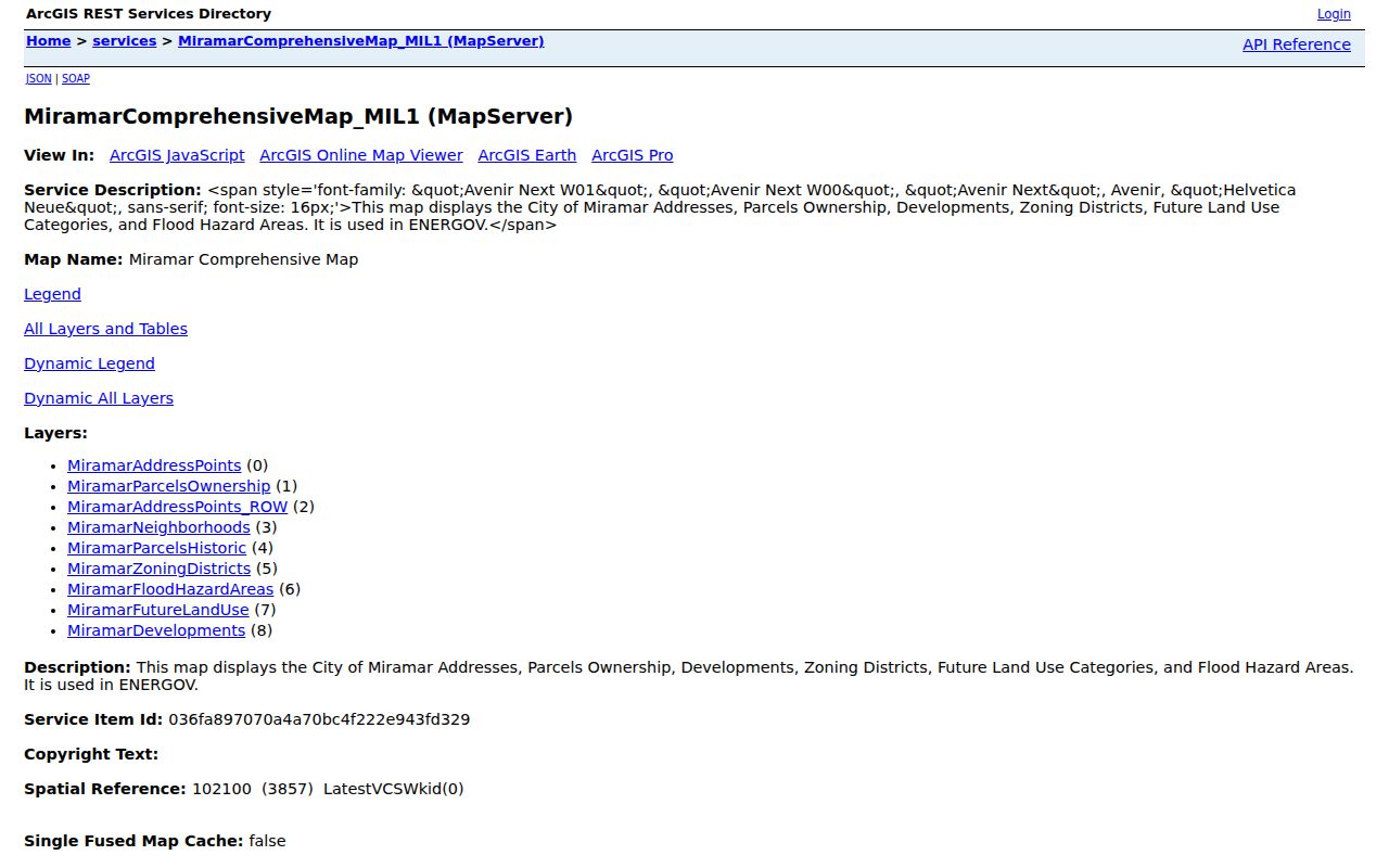
Ownership and historic-parcel layers can reveal adjoining lots and boundary changes, but BCPA and deeds remain the stronger sources for title facts.
Check Miramar Zoning by Street
Miramar's Gridics map adds a three-dimensional property view with zoning, land-use, and floodplain context. It helps explain why an address point may represent a commercial building, vacant parcel, or development rather than a residence.
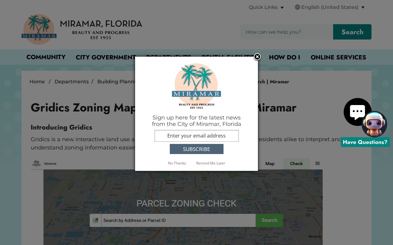
The city describes the map as informational and based partly on third-party material, so it should not replace a certified title or parcel record.
Miramar Street Directory Record Sets
Address-keyed records answer different questions along the same Miramar street. The property roll and GIS open online. Deeds begin with the owner name or folio taken from those records. Permits and city files may require a direct request. Voter street analysis uses the public data-file route rather than a personal verification screen.
| Record Set | Keeper | What It Shows | Access |
|---|---|---|---|
| Property roll | BCPA | Owner, situs, mailing address, folio, exemptions | Free portal |
| Parcel and city GIS | BCPA and Miramar | Lots, adjacent parcels, zoning, historic layers | Free maps and REST service |
| Deeds and liens | Broward RTT | Transfers, parties, dates, legal description | Modern web index, older counter media |
| Voter file | Broward Elections | Public registered-voter fields by address | $20 database search request |
| Building records | Miramar Building Division | Applicant, contractor, work, permit dates | Forms and public-record request |
The folio and legal description are the stable bridge. A street label or postal city can change as Miramar grows, but the subdivision, lot, block, and recorded plat can continue the chain.
Build Deeds Along a Miramar Street
Broward Official Records cannot reliably begin with a street address because deeds are indexed by grantor and grantee, the people or entities transferring and receiving an interest. Use the BCPA owner as the first party name. Filter to deeds, then compare the instrument, recording date, legal description, and image. The grantor on the current acquisition deed becomes a possible prior owner.
Official Records offers full party-name searching from July 7, 1977. March 9, 1972 through the cutoff has narrower instrument, book, and date modes. Pre-March 1972 work moves to Search and Copy at Broward Records, Taxes and Treasury, 115 S. Andrews Avenue, Room 114, Fort Lauderdale. County ownership documents reach 1883, while other media are reported from 1871.
- Parcel
- A legally described unit of land with a unique folio.
- Plat
- A recorded map dividing land into lots, blocks, roads, and easements.
- Situs address
- The physical address assigned to the taxed parcel.
- Criss-cross directory
- A volume arranged by street and number rather than by surname.
Request Miramar Permit Evidence
The Building Applications and Forms page provides a Building Public Records Request, Permit Lien Search Request, and related owner-builder, contractor, HOA, cancellation, and renewal forms. A permit record may identify an owner, applicant, contractor, work description, and date tied to one address.
The form asks for requester details, property or project address, permit or folio when known, requested records, and delivery information. It helps staff track the request, but Florida law does not require a special form. City Hall also accepts the correct public-record route. Residential plans may not be retained indefinitely, and a contractor or applicant should never be labeled an occupant.
Voters Along a Miramar Street
The personal Broward voter lookup verifies one voter. It is not a block browser. For lawful analysis by street, request the registered voter list from Broward Elections. Each database search is $20, an optional USB is $6, and large files may be delivered through Dropbox. Public fields generally include name, residence address, date of birth, party, status, districts, participation history, and supplied phone or email, subject to exemptions.
Ballot choices are always secret. Social Security numbers, driver-license or state-ID numbers, and registration-source data remain confidential. Address Confidentiality Program participants and other protected people may be suppressed. A voter row proves a dated registration claim, not every occupant at an address.
Insider tip. Use the paid data-file route for a full street, then confirm any individual match against a current parcel or dated filing.
Miramar Streets Changed by Growth
Miramar's main address trap is annexation and development, not a verified citywide renumbering. The original city ran from SW 64th Avenue to University Drive, between Pembroke Road and the Miami-Dade line. It later spread west toward U.S. 27 and now uses Historic Miramar, Central East, Central West, and West Miramar reporting districts.
A present parcel west of University Drive may appear in an older deed or directory under its subdivision, legal description, or a different postal city. Search the recorded plat and Broward parcel history instead of assuming “Miramar” must appear in every old index. The current ZIPs also cross postal boundaries, especially 33027 and 33029, so a Miramar mailing label alone does not prove municipal location.
Read Old Miramar Streets in Reverse
A reverse, or criss-cross, directory lists a street name, house number, occupant or business, and sometimes a phone number. Broward County Library provides U.S. city directories through Ancestry Library Edition in branches and Fold3, but its public catalog pages do not publish exact Miramar year runs. Ask the reference desk to inspect the title page, publisher, year, and street section before citing an entry.
Miramar incorporated in 1955 after its first 56-home development, so missing nineteenth-century Miramar entries are historically correct. For earlier land, use Broward and predecessor Dade records. For a complete explanation of the collections, move from the modern street directory to the Miramar city directories.
Compare Miramar Street Directory Claims
An owner, a registered voter, and an occupant are not interchangeable. BCPA proves who holds the parcel in its current roll. A deed proves that a named grantor transferred an interest to a named grantee on a recorded instrument. The voter file establishes a person's registered residence as of that file's date. A reverse directory reports what a publisher printed for one edition. None alone lists every adult, child, renter, or family relationship at the address.
| Record claim | What it supports | What it does not support |
|---|---|---|
| Parcel owner | Legal or assessed ownership | Every current occupant |
| Tax-mail recipient | Where notices are sent | The parcel's physical location |
| Registered voter | Dated registration address | All residents or ballot choice |
| Permit applicant | A role in dated work | Residence at the property |
| Directory occupant | Publisher's entry for one year | Continuous residence |
When two sources conflict, check their dates first. Then compare unit numbers, legal descriptions, middle initials, and mailing addresses. Use the newer source only for its own claim. A new deed may update ownership before a voter record changes, while a directory edition may have been compiled months before publication.
Miramar Street Search Fallbacks
Online access is only the first channel. If BCPA does not resolve an address, call the appraiser and ask about the address format, parcel map, or folio. If a deed falls before the web cutoff, contact Broward Search and Copy by phone, email, mail, or in-person counter visit. Bring the legal description, book and page, instrument, or a narrow date range whenever possible.
For city permits and code context, use the Building request category, its current form, or the City Clerk's public-record process. Florida law does not require a special form or a reason. The city may quote actual media costs or a special-service charge for extensive work and request a deposit. For old address sections, ask Broward County Library staff to check branch databases, catalog records, and volume images. These fallbacks preserve the same street-by-street method when a portal is incomplete.
Note: A narrow request with one address, record type, and date range is easier for a custodian to search and price.
Limits of Miramar Street Directory
No official Miramar street directory supplies a complete, current household roster. Property records identify ownership, not all residents. Voter data omits unregistered people and protected participants. Deeds prove transfers, while permits show a person tied to work at a place. Commercial directory tools may compile stale or mismatched data and should never outrank the official custodian.
Driver-license identifiers, Social Security numbers, registration-source details, secret ballots, protected addresses, and many vital or court details are not open. Utility data was not established as a public household list in the research. Treat silence as an access limit, not evidence that a person is absent.
Lawful use. Miramar address records support personal research, family history, property questions, and civic transparency. Never use them to stalk, harass, intimidate, or harm anyone.